Application in Geospatial Technologies Certificate

Completed Certification as a User/Analyst, see course list here.
At Mesa Community College (MCC) from 2010 to 2012, I worked towards a certificate in Geospatial Technologies, under the guidance of program director Karen Blevins. The decision to enroll was based on a recommendation from the Audubon Arizona’s Director of Conservation, Tice Supplee, who was just beginning a project with Karen. Volunteering on a bird survey one day, Tice and I began a conversation on the topic and determine the opportunity was a perfect fit for me with my graphic design skills. It was then I realized that not only would I gain a new set of skills, building on my love of maps, the internship would provide real-world conservation experience with Audubon Arizona to analyze their Important Bird Areas (IBAs). This was a once-in-a-lifetime opportunity that I could not pass up!
Through MCC’s 2-year Geospatial Technological certification program, I was able to establish a firm foundation of fundamental GIS skills such as database management, visual basics, SQL, python coding, spatial statistics, and remote sensing. Determined to understand all aspects of this technology, I worked very hard throughout the program to form a solid baseline for visualizing spatial patterns and grasping these geographical concepts. Alongside the certification, I was eager to participate in Karen and Tice’s lab immersing myself in real world conservation GIS throughout the 4 semesters. The involvement increased my confidence with the technology as I applied my newly gained skillset; building geodatabases, editing boundary shape files, and adding layers for spatial analysis (bird distributions, vegetation, ownership, topography, roads and rivers). Collectively the lab group completed over 50 Important Bird Areas and gained attention from the college with an article to highlight the experience.[1] The mentorship of both Karen and Tice has been priceless asset through my educational journey and leading me on a career path in GIS.
For my certification capstone, I worked on a regression analysis model for bird species of greatest concern for the state of Arizona based off a study in New York. Environmental Systems Research Institute (ESRI) highlighted Audubon New York’s study in an ArcNews article in 2004, “Audubon Uses GIS to Identify Important Bird Areas in New York State”.[2] With collaboration of Audubon New York’s IBA coordinator, Jillian Liner, and Tice Supplee, and invaluable advisement from Karen Blevins, I recreated a similar model for Arizona to determine location allocation of the state’s IBAs based various mathematical concepts and indices using bird conservation regions guidelines associated with vegetative land cover data and bird distribution data from Arizona Game and Fish Department.
In 2012, I took this model to McDowell Sonoran Field Institute[3] (MSFI) and analyzed the species of greatest concern for all vertebrate species (bird, mammal, reptile and amphibian) using data collected from the Arizona Game and Fish Department for the 30,000-acre preserve. This information helped guide the MSFI baseline data investigations for Flora and Fauna in Scottsdale’s McDowell Sonoran Preserve[4] that launched in 2012. It was rewarding when Melanie Tluczek, MSFI’s manager, handed me the published copy in 2015 mentioning that my maps helped guide the starting locations for fauna investigations, I was thrilled.
[1] https://www.mesacc.edu/news/press-release/important-bird-area-project-provides-learning-opportunity-mcc-students
[2] http://www.esri.com/news/arcnews/summer04articles/audubon-uses.html
[3] http://www.mcdowellsonoran.org/content/pages/fieldInstitute#sthash.4gn2f88C.EsyukZPq.dpbs
[4] https://s3.amazonaws.com/McDowellSonoranConservancyImages/fc947b63-7572-40fe-9f19-29339d412cea8207388897619413411.pdf
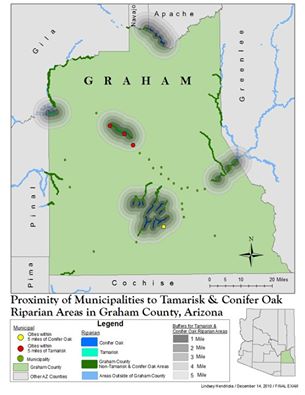
First semester Final Map
