
Four Steps to Enhanced Crowdsourcing
Posted on May 3, 2016 Leave a Comment

Over the past decade, crowdsourcing has grown to significance through crowdfunding, crowd collaboration, crowd voting, and crowd labor. The idea behind crowdsourcing is simple: decentralize decision-making by utilizing large groups of people to assist with solving problems, generating ideas, funding, generating data, and making decisions. We have seen crowdsourcing used in both the private and public sectors. In a previous article, “Empowered Design, By ‘the Crowd,'” we discuss the significant role crowdsourcing can play in urban planning through citizen engagement.
Crowdsourcing in the public sector represents a more inclusive form of governance that incorporates a multi-stakeholder approach; it goes beyond regular forms of community engagement and allows citizens to participate in decision-making. When citizens help inform decision-making, new opportunities are created for cities—opportunities that are beginning to unfold for planners. However, despite its obvious utility, planners underutilize crowdsourcing. A key reason for its underuse can be attributed to a lack of credibility and accountability in crowdsourcing endeavors.
Crowdsourcing credibility speaks to the capacity to trust a source and discern whether information is, indeed, true. While it can be difficult to know if any information is definitively true, indicators of fact or truth include where information was collected, how information was collected, and how rigorously it was fact-checking or peer reviewed. However, in the digital universe of today, individuals can make a habit of posting inaccurate, salacious, malicious, and flat-out false information. The realities of contemporary media make it more difficult to trust crowdsourced information for decision-making, especially for the public sector, where the use of inaccurate information can impact the lives of many and the trajectory of a city. As a result, there is a need to establish accountability measures to enhance crowdsourcing in urban planning.
Establishing Accountability Measures
For urban planners considering crowdsourcing, establishing a system of accountability measures might seem like more effort than it is worth. However, that is simply not true. Recent evidence has proven traditional community engagement (e.g., town halls, forums, city council meetings) is lower than ever. Current engagement also tends to focus on problems in the community rather than the development of the community. Crowdsourcing offers new opportunities for ongoing and sustainable engagement with the community. It can be simple as well.
The following four methods can be used separately or together (we hope they are used together) to help establish accountability and credibility in the crowdsourcing process:
- Agenda setting
- Growing a crowdsourcing community
- Facilitators/subject matter experts (SME)
- Microtasking
In addition to boosting credibility, building a framework of accountability measures can help planners and crowdsourcing communities clearly define their work, engage the community, sustain community engagement, acquire help with tasks, obtain diverse opinions, and become more inclusive.
Agenda Setting and Growing a Crowdsourcing Community
Agenda setting in the public sector is often a controversial process that does not include the public. However, crowdsourcing is leveraged in a few different ways to increase the community’s role in agenda setting. For instance, administrators in Central Falls, Rhode Island, used the crowdfunding platform Citizinvestor to fund community priorities. Citizens in Central Falls selected new trashcans in the local park as neighborhood priority because trash was littered throughout the park. Sixty-eight people donated money for the new trashcans. The New York Police Department (NYPD) utilizes the crowdsourcing platform IdeaScale to invite specific community to nominate problems or quality of life issues for the police to address. For instance, the100th Precinct community cited late-night noise concerns coming from a local bar. The police facilitated a meeting between concerned community members and the bar owner, who worked together to reach a mutually acceptable agreement about the noise. Facilitating the crowdsourcing community to come together and decide the issues they want to work on is beneficial to credibility because the issue being worked is what the people want. It also fosters ongoing engagement.
Ongoing engagement also grows the crowdsourcing community. At first, individuals that are interested in a single topic are likely to be the most frequent participants, but others will realize the value in the crowdsourcing platform as achievements take form. This may be common sense, but your most critical asset are the members of your community. For community members to spend their time on crowdsourcing platforms, planners need to gain their trust. When this is done, these efforts will spread amongst their families and friends, which will in turn grow the crowdsourcing community. That growth can be achieved by critically examining how well connected a community it and how this can be enhanced. Ask yourself the following questions:
- Do you offer a two-way dialogue to receive feedback?
- Do you have a team to advocate and ensure needs are met?
Oftentimes, cities are only “pushing” information out to the public, but they do not interact with the public, or for good reason. A common obstacle for productive interactions is a lack of time or manpower, but, also, communicating with the public on social media can get sticky at times. On crowdsourcing platforms, there needs to be someone available to quickly answer questions and provide feedback. This lets the community know that their work is not futile and they are working in tandem with their city officials.
Microtasking and Subject Matter Expects
Is there a code that needs to be developed to run a specific model, or is there data that needs to be curated before it is made available to the public? Microtasking could be the answer.
Microtasking is an exciting feature of crowdsourcing because, taken together, the small actions of a few can have a big impact across networks. Essentially, microtasking is the division of one large task into several smaller tasks. Perhaps the most well-known example of microtasking and its impact is Wikipedia. Wikipedia has flourished on the public’s willingness to add small bits of information to create a database of information on any and everything for the world to consume for free. Crowdsourcing platforms such as CDCology, PhillyTreeMap, and Smithsonian Transcription Center also offer opportunities for microtasking. Digital volunteers with the Smithsonian Transcription Center make historical documents more accessible by learning how to accurately transcribe field notes, diaries, ledgers, logbooks, manuscripts, and biodiversity specimens.
The most valuable aspect of microtasking is that experts or laypersons can make meaningful contributions to projects with low commitment while increasing accountability and credibility. Sites that utilize microtask presently use a two- to three-step process for information submission and approval. The processes involve leveraging the time and asset resources of the volunteers and the knowledge resources of subject matter experts (SME) who vet information and train volunteers.
A good example of this is Observations.be, an online crowdsourcing platform developed to monitor biodiversity in Belgium. The platform enables anyone who is registered to enter their observations of a number of species (e.g., birds, mammals, reptiles, insects). Participants enter their observations on a geospatial map that can include photos, sound files, and commentary. To strengthen the credibility of observations, the platform is structured to function through collective action whereby working groups are central to the platform’s function. Each working group has administrators (SME) that are responsible for validating each entry before it is integrated into the Observations.be database. Validation includes a three-step filter protocol that helps mitigate issues of misinformation being published.
The user serves as the first filter against incorrect information by categorizing their observations. If they question or doubt a categorization, they can enter “?” into the category line. In either case, a species coordinator will contact the user to help them identify the specie. The second filter comes in the form of an automatic message sent to a user who has entered a rare species observation. The message will ask the user to answer a series of questions to confirm the observation and provide a prompt to upload a photo to validate the claim. The third filter is a special coordinator (usually a specialist or veteran nature observer), who reviews the entry, questions the user on their observation (if needed), or sends a questionable entry to discussion forums of other specialists or veteran observers to either discard or accept the observation as an entry to be integrated in the larger database.
Facilitators and SMEs can also incorporate editing and fact checking into the accountability system. The infusion of editing and fact checking adds credibility to the crowdsourcing process. We don’t mean to say that facilitators and SMEs are editing community voices, but they are asking for clarification, reflecting clarification, and ensuring that information collected is presented and understood as close as possible to crowdsourcers meaning. This is crucial for making the best out of the information. Crowdsourcers can misremember information (i.e., listing the incorrect street an incident occurred or confusing two streets). It also increases the likelihood that individuals will return to the platform because they will be engaged in conversations beyond their initial post.
Conclusion
For urban planners, crowdsourcing can be appealing because of the instant access to information. Planners play a major role in guiding the development of the community, which should be done in partnership with the community. Planners should consider how they can use crowdsourcing for the good of their city and how to do so credibly. This will not happen all at once, or easily. However, it is worth the effort in the long run.
If you have experience with applying any of these strategies into your crowdsourcing efforts, please leave a comment or send us a note about your experience.
Kendra L. Smith, Ph.D. is a Post-Doctoral Scholar for Public Service and Community Solutions and a research fellow at the Center for Urban Innovation at Arizona State University. Connect with Kendra on Twitter @KendraSmithPhD.
Lindsey Collins is a Masters of Advanced Study Candidate in Geographical Information Systems in the School of Geographical Sciences and Urban Planning at Arizona State University. Connect with Lindsey on Twitter @Lmcoll1 andLindseyCollins.net.
Mapstory
Posted on April 17, 2016 Leave a Comment

![]() At Arizona State University, Decision Theater Network, I have the opportunity to assist the Mapstory organization, affiliated with BoundlessGeo, in creating story content as a student worker. Currently, Mapstory is transitioning into a new and improved web platform. I work with developers to test the platform’s functions and help with interface design layouts.
At Arizona State University, Decision Theater Network, I have the opportunity to assist the Mapstory organization, affiliated with BoundlessGeo, in creating story content as a student worker. Currently, Mapstory is transitioning into a new and improved web platform. I work with developers to test the platform’s functions and help with interface design layouts.
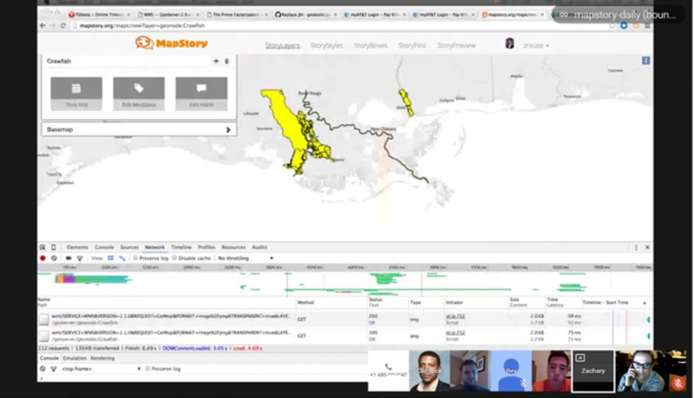
MapStory is the atlas of change that everyone can edit. We are a community, not a company, that envisions a world where everyone’s knowledge can be tapped, peer reviewed, organized and shared so that we all can dramatically improve our understanding of the rich past, complex present and uncertain future we share as living beings on planet Earth.
Profile name: Lmcoll1
Profile description: Focusing on natural capital (animal, plant, and marine biodiversity) and human impact on our planet’s ecosystems. Experience with wildlife management for organizations including; Audubon Arizona, Phoenix, Zoo, The National Audubon Society, Arizona Game and Fish, U.S. Fish and Wildlife, Liberty Wildlife Rehabilitation Foundation, BLM, Arizona State University and University of Arizona.B.S. Conservation Biology ASU GIS certificate Master’s Advanced Study of GIS, current, ASU
GIS Student Researcher
Posted on April 17, 2016 Leave a Comment

Here in the heart of Brickyard in Downtown Tempe, I currently work as a GIS student researcher. Each week, I seem to dive into new complex problems around the globe. I look forward to being involved in projects that span from
Army 3D training simulations, budget models for the State of Arizona, Mega city spatial analytics for optimal placements of health care facilities to Waste management programs origin-destination matrix models.
Decision Theater Network helps researchers and leaders to visualize solutions to complex problems. The Network provides the latest expertise in collaborative, computing and display technologies for data visualization, modeling, and simulation. The Network addresses cross-disciplinary local, national and international issues by drawing on Arizona State University’s diverse academic and research capabilities. Decision Theater develops applications to address challenges in the following broad focus areas: health solutions, sustainability, education, entrepreneurship and innovation, and security and defense. The following outlines these areas and provides examples of solutions developed.
Watch the video and learn more about the Decision Theater here.
McDowell Sonoran Field Institute
Posted on April 16, 2016 Leave a Comment

Returning to MSFI in 2015, I began an internship to assist with their GIS needs. I independently migrated their GIS data to the ArcGIS online platform learning the basic components to set up the cloud based system. In addition, I was curious about the temporal changes of the Preserve alongside the urban sprawl of Scottsdale. I developed an idea to visualize the parcel acquisition history of the Preserve and Scottsdale’s urban sprawl by using a time aware Story Map. In October 2015, I submitted this idea for the MSFI symposium as a “digital poster”, a large television monitor, to display alongside traditional research posters to actively engage participants in the Preserve’s history. The City of Scottsdale Preserve Manager, Scott Hamilton, and I discussed the history of the Preserve alongside the “digital” poster, emphasizing the importance of creating, expanding and enjoying Scottsdale McDowell Sonoran Preserve has been a community wide, grassroots movement since day one. Watching the preserve unfold in this animated map visually enhances the parcel acquisitions as it occurs through time.
For my MAS-GIS capstone, I developed a project to bring the Preserve to the 21st century utilizing ESRI’s mobile applications for field data collection and to incorporate a dynamic web based map for McDowell Mountain visitors to plan their next adventure in the Preserve. I recruited a team of master’s students to tackle ambitious endeavor with me. I work directly with the MSFI’s Manager, Melanie Tluczek, and Lead Stewards to provide a more efficient field data collection process for their citizen science programs and patroller group. MSFI’s Citizen Science group actively engages trained citizens to help collect data on flora and fauna within the Preserve, while the Patroller group monitors trail conditions ensuring the safety of the visitors by altering the construction and maintenance group where hazardous areas need attention.
Officially became a steward in October 2015
.
Masters in Advanced Study in Geographic Information Systems
Posted on April 16, 2016 Leave a Comment

Program completed during August 2015 to August 2016.
Details about the program can be reviewed here.
The Masters of Advanced Study in Geographic Information Systems (MAS-GIS) is a compact one-year nonthesis degree program fostering advanced study in the management and use of GIS technology in public and corporate environments. The degree meets important educational needs of working professionals and recent college graduates seeking to improve their career standing.
In fall 2016, I joined Arizona State University’s Masters of Advanced Study in GIS program (MAS-GIS). During the intense yearlong program, I fine-tuned my GIS skillset, participated in conferences and workshops, becoming fascinated by software development, web maps and mobile applications. Deciding to conquer my fears of coding and programing languages, I registered for ESRI’s DevSummit in Palm Springs over spring break. Though I’m not proficiently fluent in any particular language over the other, I now have a comfortable understanding of what programing offers for interactive mapping over the internet. Software engineering gives GIS experts customized styling and advanced techniques for interactive capabilities resulting in a dynamic map. Visualization is the key to capturing audiences’ attention providing innovative and interactive spatial capabilities through ease, accessibility and functionality.
I believe aspects of my graduate education follow the progression of where global environmental change is headed by using technology and innovative ways to capture data in order to understand population dynamics for biodiversity and ecosystem services. Bringing mobile data collection to gather fieldwork and integrate it seamlessly on a map to visualize concepts easily and readily is a big step in the right direction for future research projects.
For my MAS-GIS capstone, I developed a project to bring the Preserve to the 21st century utilizing ESRI’s mobile applications for field data collection and to incorporate a dynamic web based map for McDowell Mountain visitors to plan their next adventure in the Preserve. I recruited a team of master’s students to tackle ambitious endeavor with me. I work directly with the MSFI’s Manager, Melanie Tluczek, and Lead Stewards to provide a more efficient field data collection process for their citizen science programs and patroller group. MSFI’s Citizen Science group actively engages trained citizens to help collect data on flora and fauna within the Preserve, while the Patroller group monitors trail conditions ensuring the safety of the visitors by altering the construction and maintenance group where hazardous areas need attention.
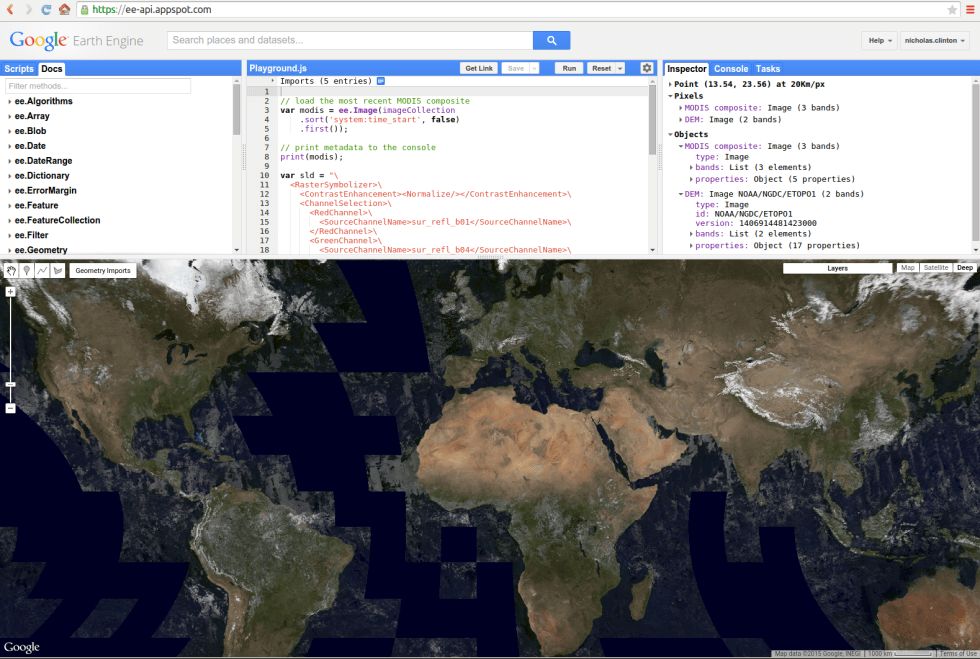
Google Earth Engine – Urban Index
Posted on April 7, 2016 Leave a Comment

Working with ASU researchers on developing an Urban Index using Google Earth Engine.
What is Google Earth Engine?
Earth Engine is a platform for petabyte-scale scientific analysis and visualization of geospatial datasets, both for public benefit and for business and government users.
Earth Engine stores satellite imagery, organizes it, and makes it available for the first time for global-scale data mining. The public data archive includes historical earth imagery going back more than forty years, and new imagery is collected every day. Earth Engine also provides APIs in JavaScript and Python, as well as other tools, to enable the analysis of large datasets.
Innovative technology sparks my excitement, so when Dr. Robert Balling invited me to participate in a project to establish an urban index script using Google Earth Engine (GEE) I accepted without hesitation. Researchers involved reside in the Geography department—Dr. Matei Georgescu, Dr. Robert Balling and 3 graduate students, Michelle Stuhlmacher, Elizabeth Tellman and Carter Wang. GEE is very powerful; the urban index script is important to validate the platform’s ability to classify urban areas without the tedious tasks of traditional remote sensing techniques. The GEE tool is a strong technique for me to utilize for future research projects when looking at spatial and temporal aspects of global environmental change. Furthering my education of higher level theories in advanced geographical application courses would be an important component to my PhD. The information that I glean from the professors and graduate students during our meetings feeds my curiosity and leaves me wanting more.
Empowered Design, by The Crowd
Posted on March 17, 2016 Leave a Comment

Article published in Planetizen, find it here.
Thursday, March 17, 2016 – 5:00am PDT by
 Lukas Maverick Greyson / Shutterstock
Planners have many opportunities to make communities more livable, sustainable, viable, amicable, and equitable. Solving complex urban problems is equivalent to completing a puzzle. Frustration arises when pieces are missing, with empty holes in plans or unfulfilled promises. Tapping into creative solutions empowered by the community provides a resource to gain a more insightful view of the big picture problems planners’ face. Traditionally, planners and other elements of government have taken a top-down approach, designing cities with very little participation or feedback from citizens. Today, however, the top-down approach is not the most optimal, given our increased access to technology, data, and citizens. That access provides us with new opportunities to leverage the wisdom of crowds through crowdsourcing.
The process of crowdsourcing gathers ideas, content, and services from the public as a collective intelligence, or wisdom of the crowds. The combined talent and skills of the community creates opportunities and cultivates new and innovative ideas. Crowdsourcing offers a platform that brings people together, where the creation of problem solving is sped up, where ideas are shared, and where knowledge is harvested. John D. Rockefeller had a vision related to crowdsourcing’s potential, “I would rather earn 1% off 100 people’s efforts than 100% of my own efforts.” By using the method of crowdsourcing, the weight of the world doesn’t need to rest solely on the shoulders of planners.
The modern strategy of crowdsourcing emphasizes a bottom-up approach to planning that is user based, innovative, and empowering to communities. Citizens are the assets of a city and with active participation, creativity and ideas will foster concepts of accountability and transparency in response to community problems. Crowdsourcing also fills gaps where government cannot act. For instance, New Yorkers are plagued with spotty cellphone reception in the subway system. Private citizens developed the Subspotting app that identifies the levels of reception through the entire subway system (totaling 660 miles of track), empowering riders to create communication strategies for fixing the problem during their daily commute.
We encourage a bottom-up approach to urban planning, but that is not to say that the bottom-up approach should replace the top-down approach. Instead the two should unite and compliment each other with certain opportunities delegated to citizens. Here, we will discuss three types of crowdsourcing for planners to consider utilizing in their city, see table 1 for details.
Opportunities Abound
Direct citizen participation can be a goldmine for gaining user-based understanding, planning, fund raising, disaster relief, or project promotions. Because the needs of communities are so diverse, there are a variety of crowdsourcing techniques available to planners and citizens when tackling challenges. Techniques like crowd review, crowd response, crowd democracy, citizen science, and crowdfunding are just a few approaches to crowdsourcing.
For instance, the issue of air quality concerns millions of citizens around the world. In response to this global challenge, Jedi Pan Zheng Xiang of Singapore is developing Airtick, an app that harnesses crowd power by utilizing selfies to estimate air quality and increase urban livability. To do this, AirTick will analyze data from selfies taken in outdoor settings, such as location, time, and sunlight, to generate a large-scale dataset. That data will combine real-time air quality data that provides accurate air quality information without the need for sensors. An added bonus of this app: the dataset will also include information about the duration and strength of sunlight around Singapore, which will assist urban planners with deciding where to deploy solar panels.
| Category | Description | Example |
| Crowd review | Promote knowledge sharing for decision making strategies. | ACTion Alexandria (an online platform and tools to make community action and problem solving easier). |
| Citizen science | Involve citizens in scientific research projects. | EPA crowdsourcing toolkit sites. |
| Crowd democracy | Promote open government. | Brazil, online participation policy development arose with the passage of the Marco Civil da Intranet, “Internet Constitution.” |
| Crowd wisdom | Solve complex challenges with innovative solutions. | WalkScope. (At WalkDenver, we believe that “people are pedestrians by design.”) |
| Crowd funding | Fund raising for businesses or projects through a collective effort. | Misereor, PlaCard – SocialSwipe. (An Interactive Charity Donation Billboard, that instantly turns credit card donation swipes into synced video on the screens.) |
Citizen science, such as AirTick, assists with gathering data that would otherwise go unnoticed. Volunteers take an active role in conducting research while working with scientific community members, often on large-scale problems. Other citizen scientists, like members of Reef Life Survey and eBird, collect data while enjoying the leisure activities of scuba diving and bird watching. Traditionally, these citizen scientists have a special interest for a specific topic and are eager to perform tasks that further issues like conservation, sustainability, and community development. With citizen science, credibility in data collection protocols and techniques are critical to enhance the likelihood of science-based decisions made from the efforts of citizens.
For citizen input to influence government and political needs, crowd democracyfulfills this gap in collaborative communication. Crowd democracy is an important way to leverage feedback loops between citizens and their government. In Brazil, significant political turmoil in the form of decades of corruption and the possibility of a presidential impeachment, 72 percent of Brazilians noted that were unsatisfied with the current state of affairs in their country, according to a 2014 Pew Global Attitudes Survey. In addition to protests, Brazilians explored new forms of expressing their will and developed the Marco Civil da Internet, or the Brazilian Civil Rights Framework for the Internet. The Marco Civil da Internet governs how the Internet will be used in Brazil outlining provisions about right to privacy, net neutrality and freedom of expression. The Marco Civil da Internet was developed with the participation of citizens, bypassing traditional legislative-based design. Thus, it is much more responsive to citizens’ concerns and less to the concerns of lobbyists.
For understanding community behavior to properly plan infrastructure, crowd wisdom brings insight to any project. Oregon Department of Transportation’s Strava Bicycle Data Project is a partnership between ODOT and Strava, a smartphone app and website that tracks cyclists via GPS. This project uses crowdsourced data to reveal cyclist behavior in the community to inform decisions about policies, plans, and projects. ODOT collected data on 17,700 cyclists who made 400,000 bicycle trips via Strava, providing insights into how cyclists used roads in and around their community. Eventually, those insights will help shape future plans and validate investments for the bicycle community’s needs. Leveraging crowd wisdom, big data, and public-private partnerships is sure to help municipalities create far better insights than using old routines of surveying a sample of users or consulting with experts. These methods are useful, but they are not optimal. The old methods will never provide as full of picture than data derived directly from citizens, and accurately collected.
Potential, Meet Challenges
Despite the potential of crowdsourcing, it is not without its challenges. Issues of facilitation and credibility are among the most significant. Planners have used techniques to successfully facilitate discussion in the traditional citizen engagement via town hall session and forums. The virtual world, however, requires a different approach. Social media, cloud-based technology, and mobile applications have provided more opportunity to engage and connect with communities, but that doesn’t mean that all engagement is fair and balanced. On some sites, a few can dominate an entire discussion. For instance, in the first phase of theMarco Civil da Internet, researchers found that two individuals contributed over two-thirds of the comments. Other challenges of gathering technological ‘wisdom’ include providing equitable access to technology, utilizing tools in the most effective manner, and engaging the public in an appropriate manner.
Issues of credibility in the process of crowdsourcing are also a critical challenge, leading to the underutilization of crowdsourcing among planners. Crowdsourcing credibility speaks to the capacity to trust a source and discern whether information is, indeed, true. For planners to use insights derived from crowds, there has to be some semblance of truth to the information. If not, planners would be derelict in their duties, not providing any service to the community. We will discuss in greater detail crowdsourcing credibility in a follow-up piece.
Effective problem solving is a job for the entire community. Crowdsourcing gives planners an edge in strategically engaging citizen participation, along with data and technology. Planners will be challenged by crowdsourcing to find new ways to facilitate the process, build credibility in the process, and merge the new processes with ongoing processes, but that work is worth it. Considering the old adage, “if you’re not apart of the solution, you’re apart of the problem,” planners should most certainly consider inviting and encouraging open innovation in their city, if they haven’t already.
Share with us your wins, challenges, and failures, so best practices can be developed.
Lindsey Collins is a Masters of Advanced Study Candidate in Geographical Information Systems in the School of Geographical Sciences and Urban Planning at Arizona State University. Connect with Lindsey on Twitter @Lmcoll1.
Kendra L. Smith, Ph.D. is a Post-Doctoral Scholar for Public Service and Community Solutions and a research fellow at the Center for Urban Innovation at Arizona State University. Connect with Kendra on Twitter @KendraSmithPhD.
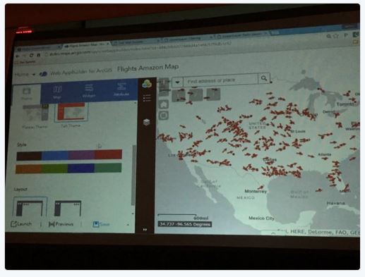
Esri’s DevSummit
Posted on March 8, 2016 Leave a Comment

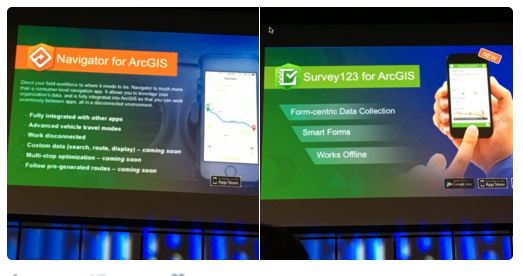
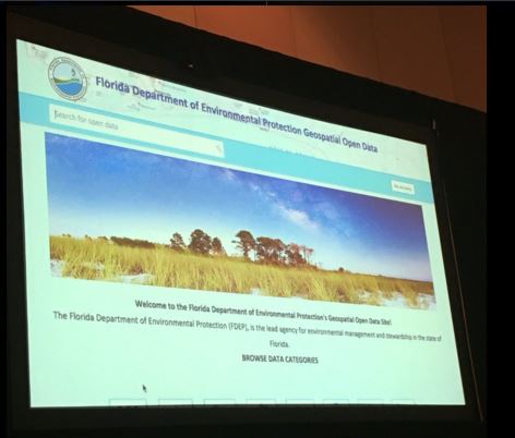
Esri Developer Summit was the first time I really dove deep into the back end of GIS. It opened my eyes to the customization you can provide for applications, web and mobile.
Talks I attended included:
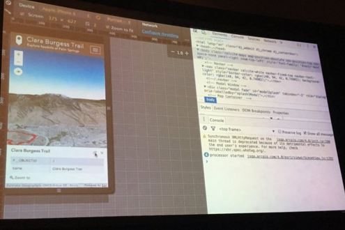
 sourcing with Story maps
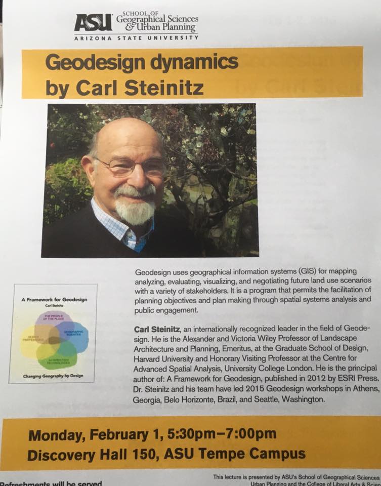
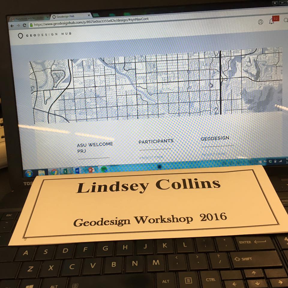
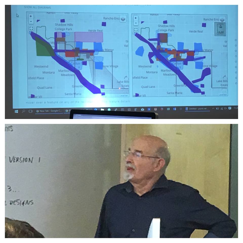
Geodesign Workshop
Posted on February 2, 2016 Leave a Comment

ASU hosts geodesign workshop for Valley’s best and brightest
Designers, developers come together to brainstorm ideas for a sustainable desert city
February 5, 2016
Geodesign and urban development may not be the sexiest words in the dictionary, but it’s the meaning behind these titles that generates a lot of interest among students and faculty alike.
Arizona State University recently hosted about 15 different organizations at a design and development workshop on the Tempe campus. During the two-day seminar, community representatives, stakeholders and academics met to work out the details of future urban planning in Phoenix. Among the organizations were Native American tribal representatives, economic development directors and community relations officers.
The purpose of the workshop was to demonstrate the use of digital geodesign tools to create a sustainable city in a desert landscape. The focus: Northwest Phoenix, where plans are being laid out to redesign the area around the Thunderbird Global School of Management, which ASU acquired a year and a half ago.
The designers and developers aim to help everyone impacted by new developments in the area by determining the best possible layouts for new construction projects. This is done primarily through geodesign’s most powerful tool: geographical information systems (or GIS), which allows planners to analyze and evaluate future land-use scenarios with various stakeholders.
The workshop also explored environmental factors, such as CO2 emissions and water conservation.
“Every scientific body that I go to talks about how to create simulation models for the future so that our cities are more sustainable,” said Patricia Gober, interim director at ASU’s School of Geographical Sciences and Urban Planning. “The ability to use these models and fuse them with public debate and discussion helps us tackle climate change issues.”
“The engagement and conversations are positive,” said workshop attendee Bobbi Magdaleno, director of community relations at ASU’s Office of Public Affairs. “It’s exciting because we’re talking about things like growth, change and vision.”
“[The workshop] is an opportunity for students to have hands-on experience,” said attendee David P. McAlindin, assistant director at Glendale’s Office of Economic Development. “The students can look at how they can better communities with tools that are available to them.”
The workshop also helped kick off a proposed new master’s program in geodesign at ASU.
According to Gober, the master’s program is a perfect example of how ASU searches for ways to be part of the community, and that there has been a high level of interest from students both locally and internationally.
“I think that the participants and community reps were quite excited by the tech and social processes surrounding geodesign. They saw real potential to develop things for the future,” she said.
Esri’s SW User Conference
Posted on January 20, 2016 Leave a Comment
Join us in Phoenix for three days of learning, training, and engaging with Esri staff on the issues that matter to your organization. The Esri Southwest User Conference is the best way to learn about how Esri is evolving GIS. Get first-hand experience with the ArcGIS platform and pick up new skills in the Hands-on Learning Lab. Plus, hear from local area leaders who are tackling the challenges of the Southwest with GIS and designing a better future.
ESRI SW User Conference
Web applications
Climate change/vineyard suitability

Renaissannce Downtown Phoenix
ESRI SW User Conference Day 2
LiDAR
Collector
3D City Model
Spatial Data mining
